Business Impact
Drive Measurable Grid Reliability
Location intelligence turns reactive grid maintenance into a proactive, data-driven program with quantifiable results.
Fewer Vegetation Outages
Risk-based, GIS-driven vegetation management can cut vegetation-related outages by up to 30% versus fixed trim-cycle schedules.
Verified Software ROI
Utilities investing in software-driven vegetation and asset analytics have realized a 74% return through avoided emergency work and optimized crews.
Outages Caused by Trees
Nationwide, trees are responsible for roughly a third of all distribution-line outages — GIS risk zoning targets the spans that matter most.
Lower Vegetation Spend
Optimized trim scheduling and avoided emergency callouts can reduce total vegetation management costs by up to 20%.
Industry benchmarks based on published utility vegetation-management and grid-reliability research; actual results vary by service territory.
How It Works
From Field Asset to Grid Intelligence
A guided workflow that turns raw field data into a proactive, reliability-driven grid management program.
Digitize Grid Assets
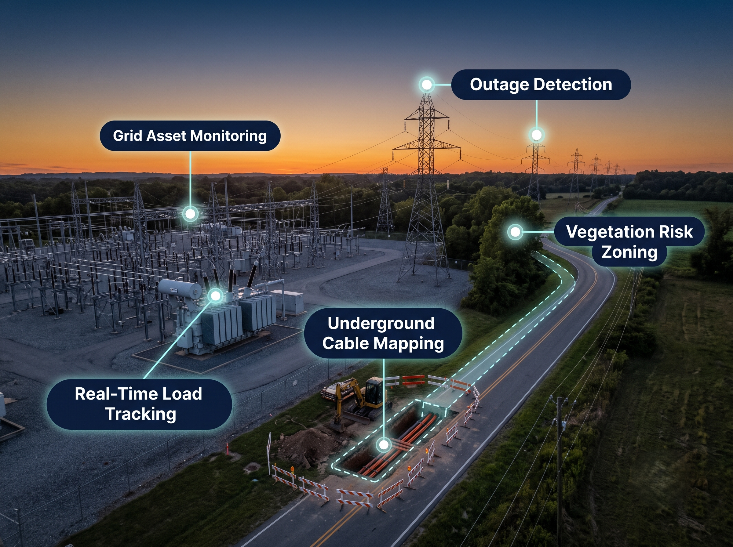
Map every pole, conductor, transformer, and switchgear into a unified GIS registry.
Assess Vegetation & Outage Risk
Use imagery and risk zoning to flag high-priority spans before failures happen.
Plan & Deploy Upgrades
Prioritize hardening, undergrounding, and maintenance where it reduces the most outage-hours.
Monitor in Real Time
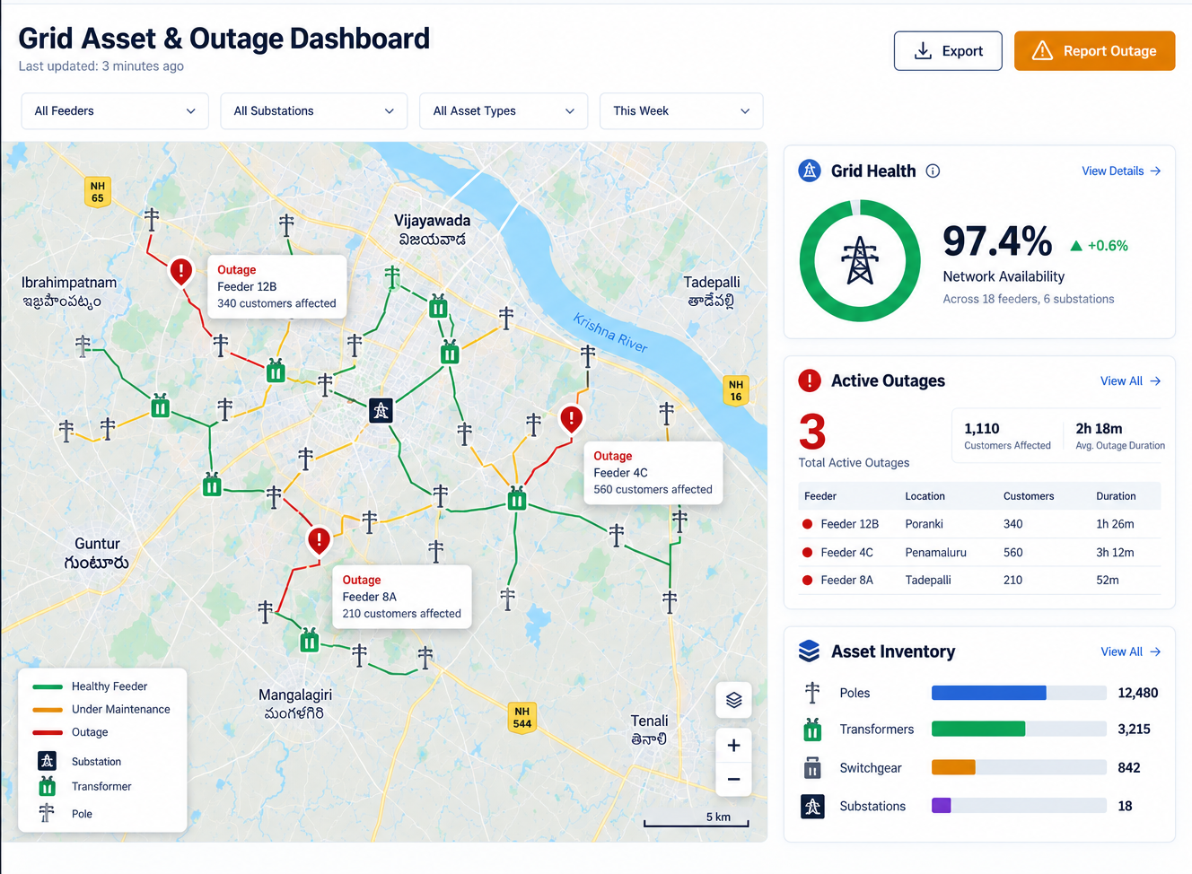
Track grid health, active outages, and crew response from a live dashboard.
Our Solutions
Comprehensive Utility Solutions
End-to-end geospatial solutions tailored for electrical distribution utilities — from asset mapping to outage response.
Distribution Network Mapping
Digitize every pole, conductor, transformer, switchgear, and underground cable into a single GIS asset registry with full lifecycle attributes.
Outage Management & Fault Location
Integrate GIS with SCADA/ADMS to pinpoint faults instantly, isolate affected segments, and dispatch crews to the exact outage location.
Vegetation Management & Risk Zoning
Use LiDAR and aerial imagery to detect encroachment risk along every span and prioritize trim crews on the highest-risk corridors first.
Smart Grid & Network Modeling
Model your distribution network on a CIM-aligned data structure that supports smart meters, DERs, and grid modernization programs.
Joint Use & Pole Attachment Management
Track joint-use agreements, pole loading analysis, and NESC clearance compliance for every telecom and cable attachment on your poles.
Regulatory Compliance & Reliability Reporting
Automate SAIDI/SAIFI reliability reporting and maintain audit-ready compliance records for state and federal regulators.
Real-World Applications
Proven Solutions for Complex Grid Challenges
See how utilities worldwide leverage geospatial intelligence to solve their most demanding network challenges.
Storm Hardening & Resilience Planning
Model storm exposure across your service territory and prioritize hardening investments — undergrounding, pole upgrades, and tree trimming — where they reduce the most outage-hours.
Rural & Regional Grid Expansion
Plan new distribution lines and substation feeds with terrain-aware routing that balances build cost against reliability and future load growth.
Underground Cable & Conduit Management
Maintain an accurate, depth-mapped record of every underground duct, cable, and vault to speed up locates and cut accidental-strike risk during excavation.
Distributed Energy Resource (DER) Integration
Track rooftop solar, storage, and EV-charging interconnections against feeder capacity to keep the grid stable as distributed generation scales up.
Platform Capabilities
Complete Grid Management Capabilities
Everything you need to map, maintain, and modernize an electrical distribution network with confidence and precision.
The TriCAD Platform
Built for Utilities with TriCAD
Utilities solutions are powered by the same modules driving GIS asset management, field operations, and program delivery across TriCAD.
GIS Inventory
Maintain a complete, geolocated registry of every pole, transformer, and grid asset.
FieldOps
Dispatch and track crews responding to outages and maintenance work orders.
Project Management
Coordinate multi-contractor grid hardening and upgrade programs at scale.
Get Started
Ready to Modernize Your Electrical Grid?
Discover how our geospatial platform can help you cut outages, speed up restoration, and manage every pole, line, and transformer with confidence.